Identifying Avalanche Terrain
There are several methods to identify avalanche terrain. In approximate order of reliability, they are:
|
Topics
|
Historic Records
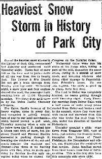
A long history of well-documented observations provides a data set that proves where avalanches have occurred and can be used
to deduce potential runout distances by applying statistical methods. Many locations in Europe have historic records dating back
hundreds of years. In North America, records are limited to just over 100 years, and are often incomplete. Archived newspapers,
State and Local Historic Preservation groups and libraries are primary sources for information.
|
|
Slope, Terrain and Avalanches

Wet Slide Inyo County, CA 1986 |
Most avalanches start on unforested slopes or those with a dispersed tree cover on angles between 30 and 50 degrees.
There is a slight bias toward steeper terrain in coastal climates. Thus, if there are no slopes within this range above
a site, and the area is heavily forested, it is probably not avalanche terrain. A few important exceptions exist,
including lee slopes steeper than 25 degrees, and high latitude locations where "slush flows" are possible on slopes
of 10 to 20 degrees. Many avalanche paths are confined to gullies and natural drainage channels. However, avalanches
can also occur on broad open unconfined slopes. Terrain analysis to determine avalanche size and runout potential
requires knowledge of climate, altitude and an estimation of potential snow supply, the starting zone shape, area,
connectivity, fracture heights, and the sequence of slab releases. The possible types and sizes of avalanches also
affect runout zone size and shape. Large, relatively-cold dry-slab avalanches may attain high velocities and tend
to maintain their flow direction, whereas warmer wet avalanches have lower velocities and are more likely to be
deflected by terrain features. |
Vegetation Indicators
 |
Some avalanche paths are quite obvious because they run frequently enough to prevent establishment of mature
forests or other vegetation. Dendrochronology can be used to determine the age of trees and this might indicate
the time period since the last major avalanche. It might also reflect the time since a forest fire or timber
harvesting event. Not all sites are forested, so this method is not always possible. Furthermore, the
probability that a rare (100-year or 300-year) event has occurred during a given time period entails some uncertainty.
Vegetation damage, while a good indicator of past events, does not necessarily show the size of an avalanche which
must be planned for. Topography and potential avalanche velocity at various points in a path are better indicators
of runout extents. |
Geomorphology
Avalanches often transport soil, rock and other debris and leave deposits in their runout zones. Depending on the frequency of avalanches
and the geologic character of the starting zone and track, debris deposits can indicate the limits and frequency of some avalanche paths.
